search
Sweden postcode map
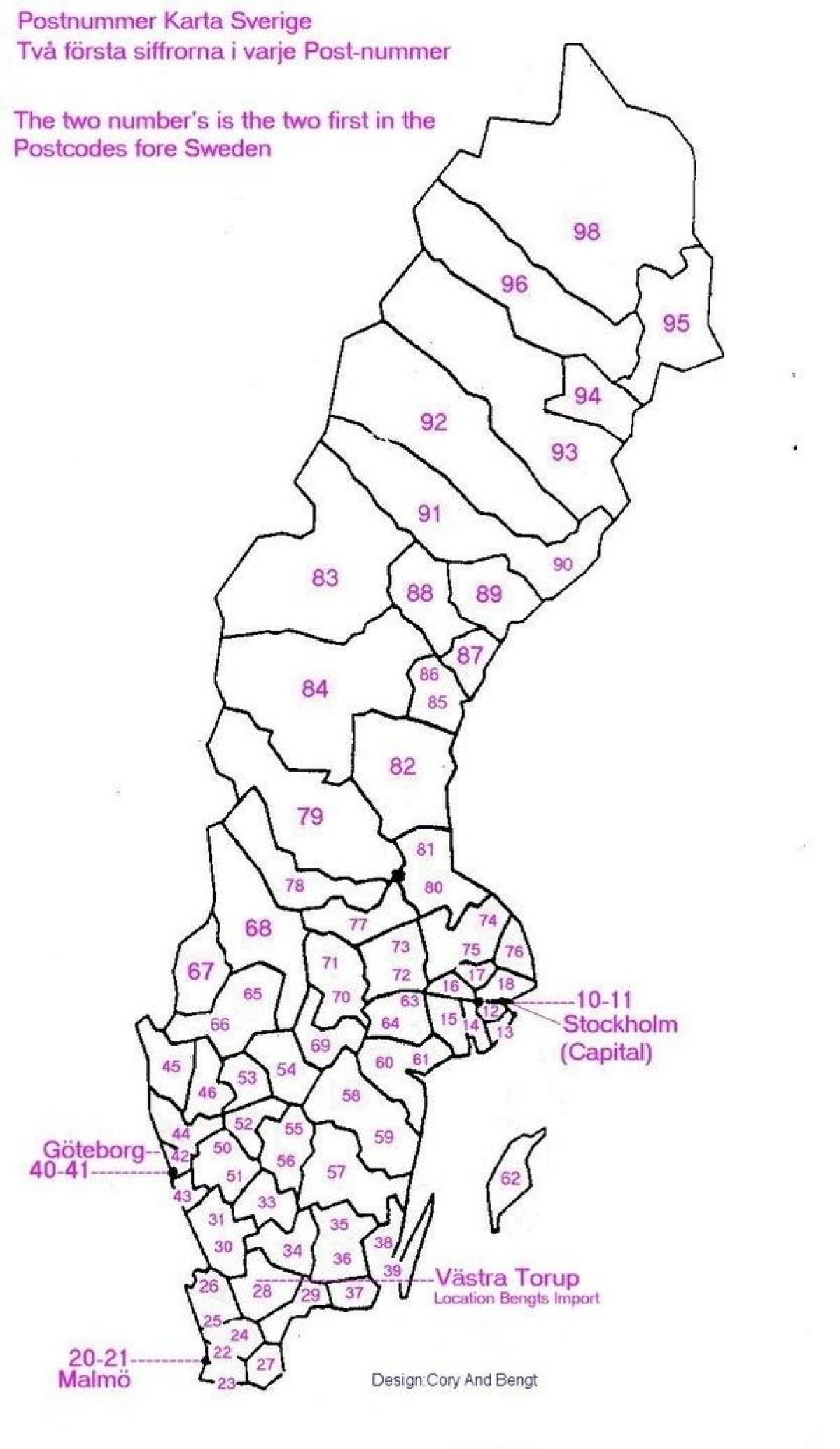
Map of Sweden postcode. Sweden postcode map (Northern Europe - Europe) to print. Sweden postcode map (Northern Europe - Europe) to download. The postcode in Sweden consists of 5 digits,divided into two groups of three and two digits. There is a space between the two groups as its shown in Sweden postcode map. The Swedish postal code system is developed by the Swedish national postal service (Posten AB) on behalf of the Swedish Post and Telecom Authority. This postal code system is used to divide Sweden into different areas. With this system each Swedish region gets a unique code and locations can be found easily. Postal codes in Sweden are known as postnummer. The postal code system in Sweden was introduced in 1968. The average area for zip codes in Sweden is 45.8 km² with the largest being 982 99 in Norrbotten at 8,028.5 km² and the smallest being 433 66 in Partille, Västra Götalands län at 108 m².
This map depicts the boundaries of 5-digit postal code or districts within the country of Sweden. These 5-digit postal are the highest level in the current Swedish postal code system. The official 5-digit postal code contains the following characters and features: The first digit represent a specific Swedish region, the second and third digit represent a specific city or area, the last two digits feature a certain district. The current postal code (postnummer) range of Sweden (SE) is: 11115 – 98499 as its mentioned in Sweden postcode map. The lowest 5-digit postal code (11115) starts in the Swedish capital of Stockholm. The highest postal code (98499) is located in the municipality of Pajala.


