
search
Geological map Sweden
Map of geological map. Geological map Sweden (Northern Europe - Europe) to print. Geological map Sweden (Northern Europe - Europe) to download. Sweden is part of the Fennoscandian Shield, an area of old crystalline and metamorphic rocks, consolidated during hundreds of millions of years. Common rocks are gneiss, granite, granodiorite, sandstone and marble as its shown in geological map Sweden. The overburden is mainly formed by numerous periods of glaciation and deglaciation. The most common soil type is till, covering about 75 % of the landscape. The Swedish landscape is full of variety and has been shaped by dramatic events in its geological history such as earthquakes, volcanism and glaciations. The bedrock and the composition of the soil cover and their geological history have largely shaped the natural conditions and the landscape as it is today, as well as the natural resources that are available to us.
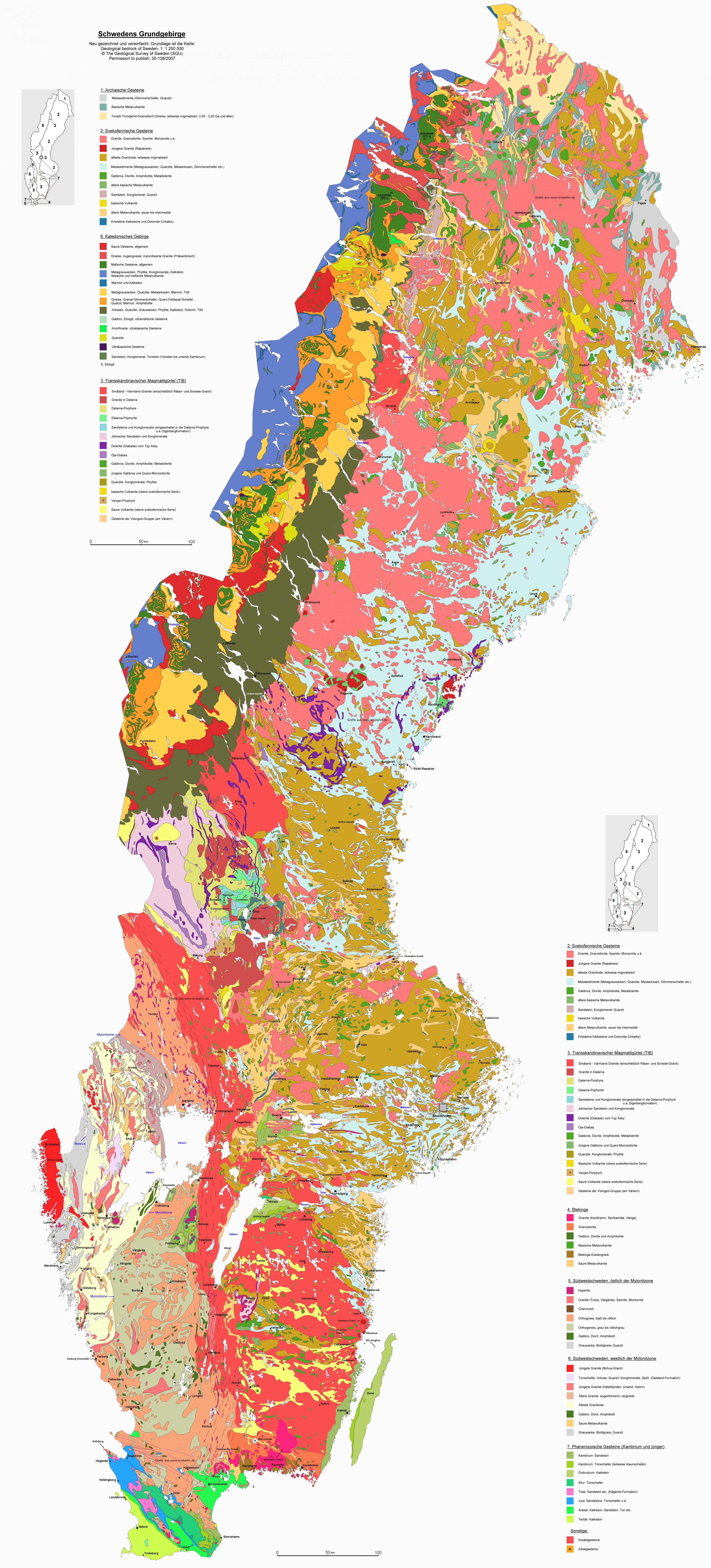
Sweden occupies the greater part of the Scandinavian Peninsula, which it shares with Norway. The land slopes gently from the high mountains along the Norwegian frontier eastward to the Baltic Sea. Geologically, it is one of the oldest and most stable parts of the Earth crust. Its surface formations and soils were altered by the receding glaciers of the Pleistocene Epoch (about 2,600,000 to 11,700 years ago) as its mentioned in geological map Sweden. Lakes dot the fairly flat landscape, and thousands of islands form archipelagoes along more than 1,300 miles (2,100 km) of jagged, rocky coastline. Like all of northwestern Europe, Sweden has a generally favourable climate relative to its northerly latitude owing to moderate southwesterly winds and the warm North Atlantic Current.