search
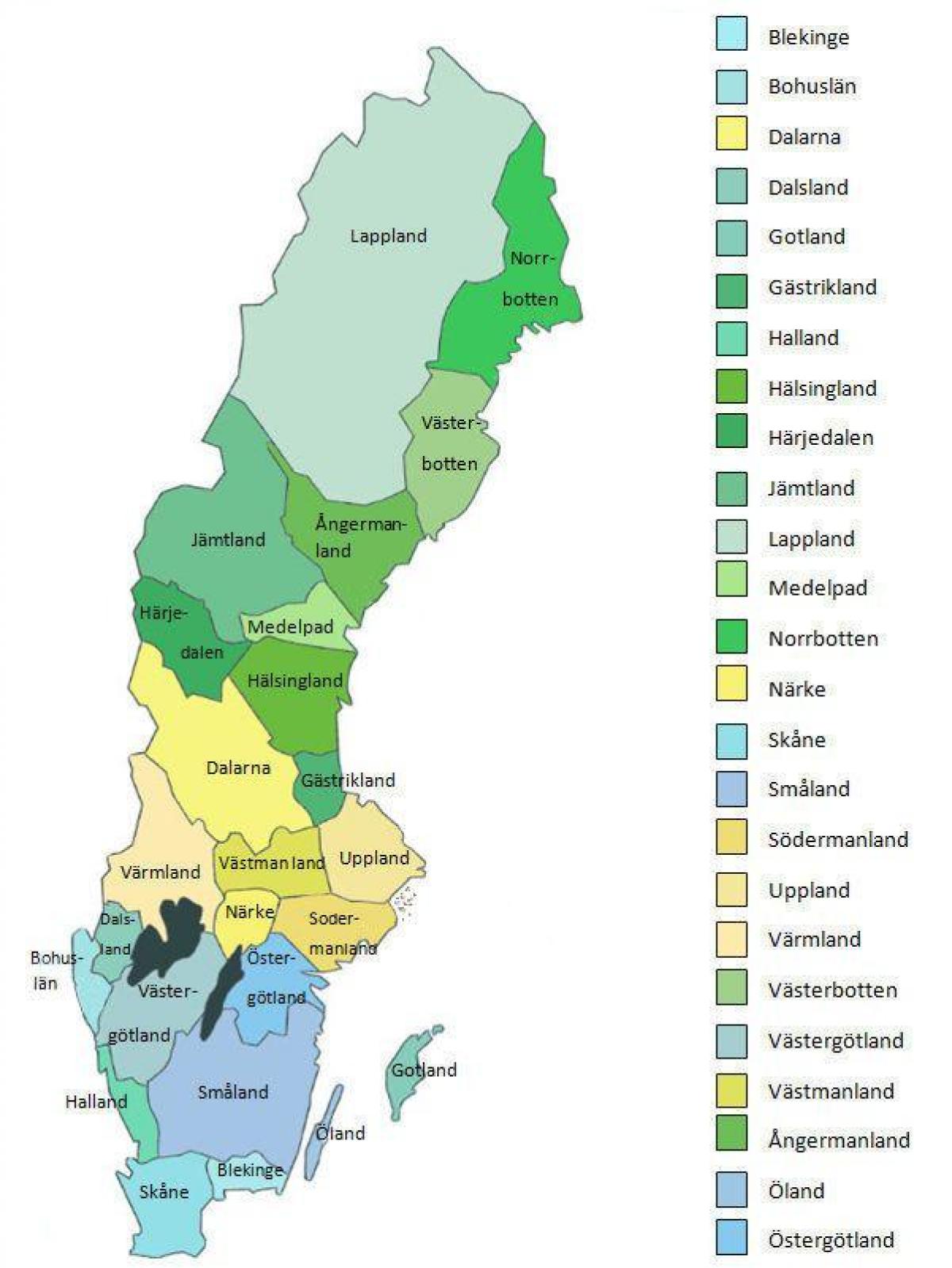
Sweden provinces map
Map of Sweden provinces. Sweden provinces map (Northern Europe - Europe) to print. Sweden provinces map (Northern Europe - Europe) to download. The provinces of Sweden, landskap, are historical, geographical and cultural regions. Sweden has 25 provinces and they have no administrative function, but remain historical legacies and the means of cultural identification as itsshown in Sweden provinces map. Several of them were subdivisions of Sweden until 1634, when they were replaced by the counties of Sweden (län). Some were conquered later on from Denmark–Norway. Others like the provinces of Finland were lost. Lapland is the only province acquired through colonization. In some cases, the administrative counties correspond almost exactly to the provinces, as is Blekinge to Blekinge County and Gotland, which is a province, county and a municipality. While not exactly corresponding with the province, Härjedalen Municipality is beside Gotland the only municipality named after a province.
The provinces of Sweden are still used in colloquial speech and cultural references as its mentioned in Sweden provinces map. The provinces of Sweden can therefore not be regarded as an archaic concept. The main exception is Lapland where the population see themselves as a part of Västerbotten or Norrbotten, based on the counties. Two other exceptions are Stockholm and Gothenburg, where the population see themselves as living in the city, not in a province, since both cities have province borders through them.


