search
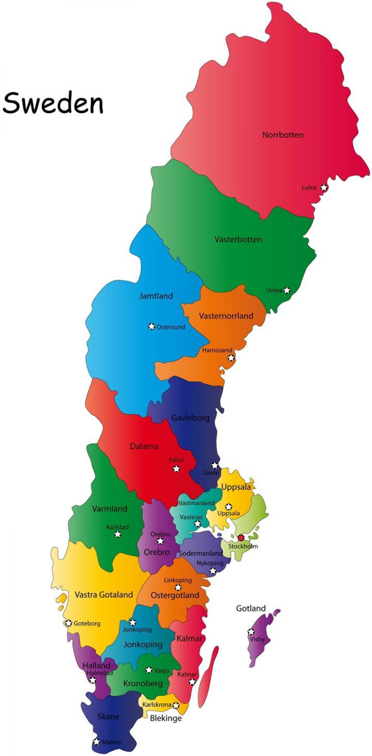
Sweden map counties
Map of Swedish counties. Sweden map counties (Northern Europe - Europe) to print. Sweden map counties (Northern Europe - Europe) to download. The Counties of Sweden (Swedish: län) are the first level administrative and political subdivisions of Sweden. Sweden is divided into 21 counties as its shown in Sweden map counties. The counties were established in 1634 on Count Axel Oxenstierna initiative, superseding the historical provinces of Sweden (Swedish: landskap) to introduce a modern administration. At that time, they were what the translation of län into English literally means; fiefdoms. The county borders often trail the provincial borders, but the Crown often chose to make slight relocations to suit their purposes. There are controversial proposals to divide Sweden into larger regions, replacing the current counties.
In each county there is a County Administrative Board (länsstyrelse) headed by a governor (landshövding) as well as a County Council and several other government organisations. Each county is further divided into municipalities (kommuner), the existence of which is partly at the discretion of the central government. Since 2004 their number has been 290, thus an average of 13.8 municipalities per county. (See Sweden map counties). Until 1968, the City of Stockholm had its own "county code" A, which is still used interchangeably with AB in some contexts, and County of Stockholm had county code B. L was for Kristianstad County and M was for Malmöhus County but since they were merged to form Scania County, M is usually used. O used to stand for Gothenburg and Bohus County but has been used for West Götaland County since it was merged with Skaraborg County (R) and Älvsborg County (P).


