search
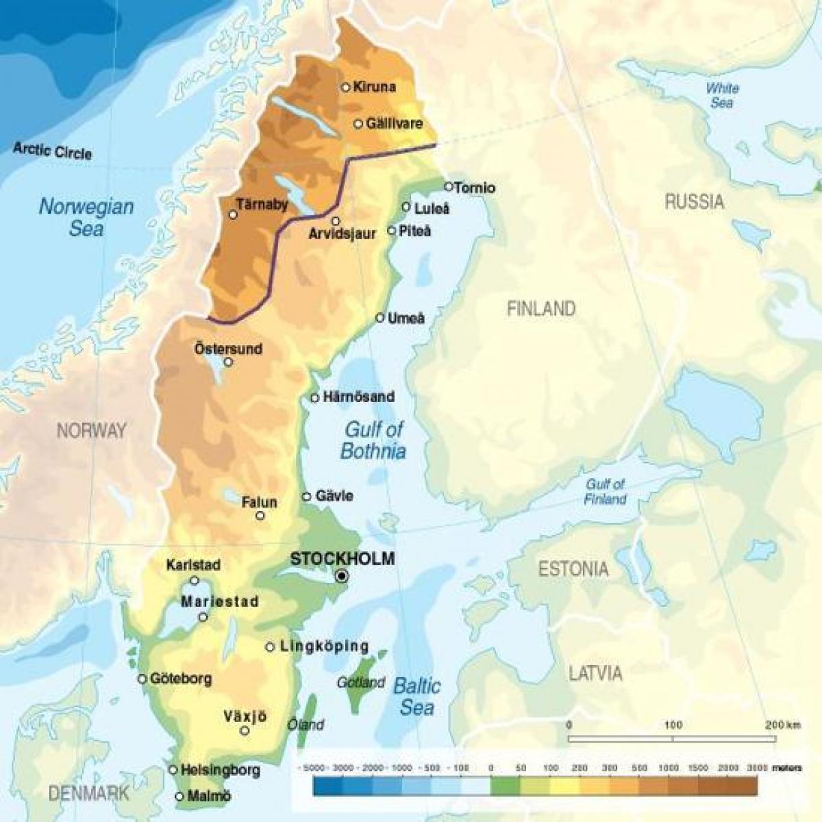
Sweden elevation map
Map of Sweden elevation. Sweden elevation map (Northern Europe - Europe) to print. Sweden elevation map (Northern Europe - Europe) to download. The highest point is Kebnekaise at 2,111 m (6,926 ft) above sea level as its shown in Sweden elevation map. Kebnekaise (from Sami Giebmegáisi or Giebnegáisi, "Cauldron Crest") is the highest mountain in Sweden. The Kebnekaise massif, which is part of the Scandinavian Mountains, has two peaks, of which the southern, glaciated one is highest at 2,106 metres (6,909 ft) above sea level at the latest time of measurement. The north top (2,097 metres (6,880 ft)) is free of ice. Kebnekaise lies in Lapland, about 150 kilometres (ca. 90 miles) north of the Arctic Circle and west of Kiruna near the popular Kungsleden hiking trail between Abisko and Nikkaluokta. The glacier has shrunk, and therefore the summit is not as high as earlier. The top is traditionally said to be 2,111 metres (6,926 ft), and higher in the oldest measurement, i.e. 2,117 metres (6,946 ft).
The lowest elevation in Sweden is in the bay of Lake Hammarsjön, near Kristianstad at −2.41 m (−7.91 ft) below sea level as its mentioned in Sweden elevation map. Hammarsjön is a lake in Örebro County and has an elevation of 55 metres. Hammarsjön is situated northwest of Stensta, southeast of Stora Borrsjön. Its Latitude is 59.5167° or 59° 31' north and its Longitude is 15.4333° or 15° 26' east. The bay was drained in the 1860s by John Nun Milner, an engineer, to get more arable land for Kristianstad.


