search
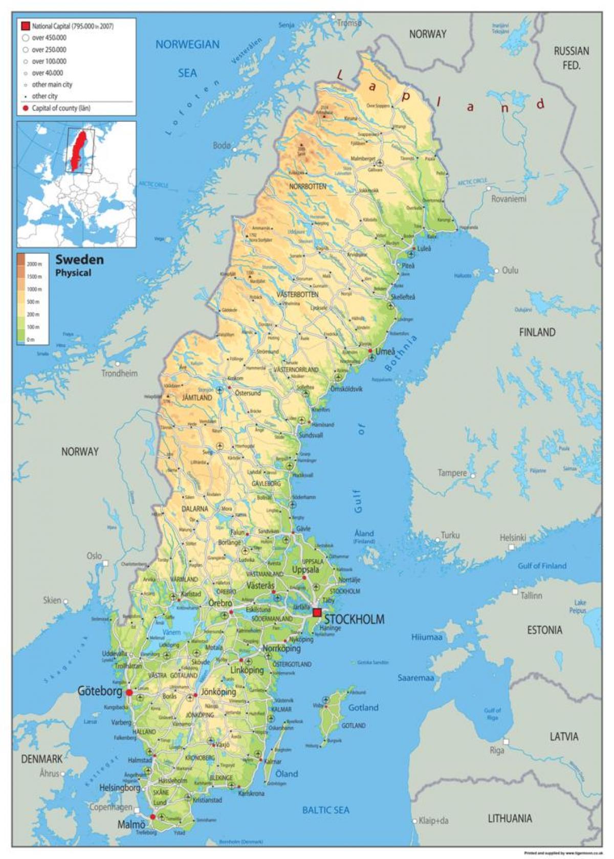
Sweden physical map
Physical map of Sweden. Sweden physical map (Northern Europe - Europe) to print. Sweden physical map (Northern Europe - Europe) to download. As observed on the physical map of Sweden, to the north (above the Arctic Circle) Sweden is rugged with snow-covered mountains and thick forests. Central Sweden is dominated by lower mountains in the west that give way to heavily forested hills and ridges, dozens and dozens of rivers and an estimated 101,000 lakes. In the south, large lakes (some linked by canals) and widely cultivated plains stretch across the land.
The country has a 3,218 km (2,000 mi) long coastline to the east as its shown in Sweden physical map. Sweden coastal areas include several small islands and reefs, especially in the east and southwest. Directly south of Stockholm (a city of islands) are Gotland and Oland, Sweden's largest islands. White sandy beaches are common along the southern coastline. Significant lakes include Siljan, Storsjom, Varern and Vattern, and with few exceptions, the balance of Sweden lakes are on the small side. Sweden's largest rivers include the Angerman, Eman, Indal, Lagan, Ljusnan, Lule, Osterdal, Skellefte, Storuman, Torne and Ume.


