search
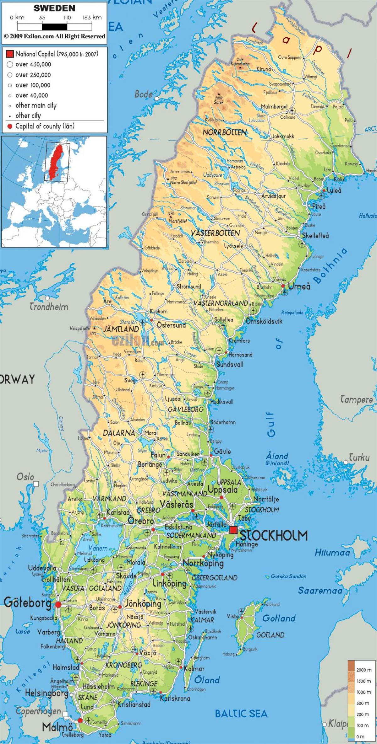
Sweden geography map
Geographical map of Sweden. Sweden geography map (Northern Europe - Europe) to print. Sweden geography map (Northern Europe - Europe) to download. Sweden land area is about 450 000 km2 with a distance between the extreme northern and southern points of almost 1 600 km as its shown in Sweden geography map. Geographically Sweden is dominated by forests, lakes and rivers, but with a great variation in landscape, temperature and natural resources, affecting conditions for industry, agriculture etc. The border to Norway runs parallel to a range of mountains. There are thousands of islands off the 2 700 km long coast. The cultivated area amounts to around ten per cent of the land surface area. There are many unique geographical features in Sweden. One of them is where the three rivers meet in Dalarna, and long the way you will find great views and “fjärdar” (narrow coastal inlets). It is a trip that will take you from the Norwegian border in west to the Baltic sea in east.
Sweden lies to the southwest of Finland. A long coastline forms the country eastern border, extending along the Gulf of Bothnia and the Baltic Sea; a narrow strait, known as The Sound (Öresund), separates Sweden from Denmark in the south. A shorter coastline along the Skagerrak and Kattegat straits forms Sweden border to the southwest, and Norway lies to the west. Sweden extends some 1,000 miles (1,600 km) to the north and south and 310 miles (500 km) to the east and west as its mentioned in Sweden geography map. The country is traditionally divided into three regions: to the north is Norrland, the vast mountain and forest region; in central Sweden is Svealand, an expanse of lowland in the east and highland in the west; and in the south is Götaland, which includes the Småland highlands and, at the southern extremity, the small but rich plains of Skåne. In the far north the region of Lappland overlaps Norrland and northern Finland.


